Data collection and analysis was a core component of the LOCATE project, providing the first strategic national insight for the fate of carbon from land to the ocean.
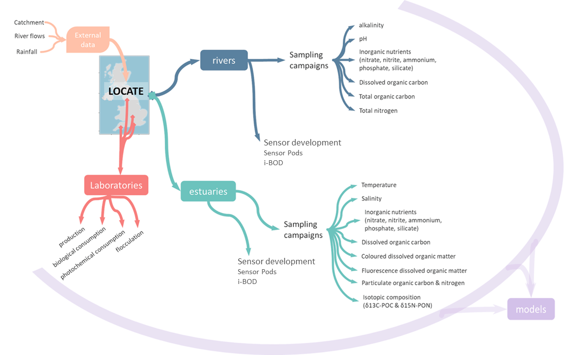
Being a multidisciplinary collaborative project, the success relied on the collection, coordination and sharing of the data generated across partners. These data can be divided in metadata, environmental data, laboratory data and relevant external data.
Metadata
Data that provide contextual information about the samples taken. For example, location of the sampling points, dates, times, etc.
Environmental data
This is data collected during the sampling campaigns as well as data provided by the sensors measuring in real-time. It includes data from samples collected by individuals at specific sampling times, such as inorganic nutrients, dissolved and particulate organic carbon, etc. The environmental data gathered provide information on the inorganic and organic matter origin, amount of nutrients and terrigenous organic matter transported from land to coastal waters, as well as their characteristics and properties.
Laboratory data
Data generated during experiments in the different laboratories. The laboratory data provide in depth understanding of the processes that affects the organic matter during its transport across the rivers and estuaries, as well as the influence of different environmental factors (light, nutrients ionic strength, etc.) on these processes.
External data
Relevant data outside the LOCATE project but of interest for the project collected and provided by other institutions. For example, river flow rates and catchment information provided by the National River Flow Archive (www.nrfa.ceh.ac.uk). The LOCATE project benefits from UK coastal and North Atlantic data stored in repositories, as well as from a great variety of previous NERC programmes to contextualise its findings.
All data are of invaluable importance for the LOCATE model evaluation work, which provided a conceptual understanding of how the organic matter is transported and processed in UK freshwaters and marine systems. The data are also of value to assess the impact of land-use and climate change on the amount of terrestrial organic carbon transferred from land to coastal areas.
All LOCATE data is freely and publicly available through the NERC data centre portals.